")
Land Development with Civil CAD: Turning Raw Land into Smart, Sustainable Infrastructure
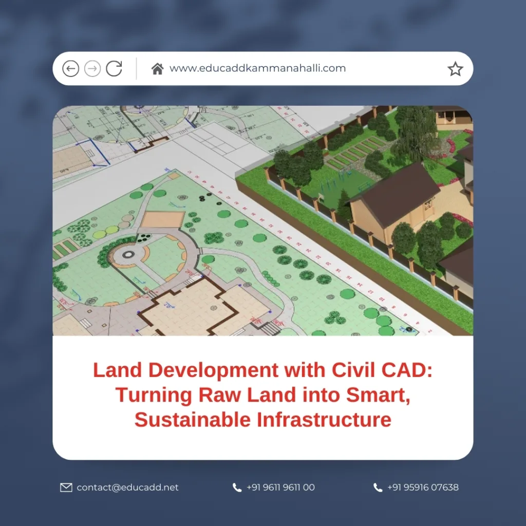
Land development no longer depends on manual drawings or disconnected planning methods. Today, engineers, planners, and developers rely on advanced digital tools to design land efficiently and responsibly. Civil CAD Land Development has become a crucial process in shaping residential, commercial, and industrial projects across the world.
Civil CAD software allows professionals to visualize terrain, design infrastructure, analyze constraints, and optimize land use before construction begins. As land availability decreases and regulations increase, precision and planning accuracy matter more than ever. With Civil CAD, teams reduce errors, save time, control costs, and deliver sustainable results.
Civil CAD Land Development
This blog explores everything you need to know about Civil CAD Land Development, from core concepts to workflows, benefits, challenges, and future trends. If you want to understand how modern land projects succeed, this guide will give you complete clarity.
Understanding Land Development with Civil CAD: Core Concepts Explained
Land development involves transforming undeveloped land into usable spaces that support infrastructure, buildings, and utilities. Civil CAD software plays a central role in managing this transformation with accuracy and efficiency.
At its core, Civil CAD Land Development includes site planning, grading design, road alignment, drainage systems, and utility layouts. Engineers use digital terrain models to study elevations, slopes, and contours. These models help teams make informed decisions early in the project lifecycle.
Unlike traditional drafting, Civil CAD integrates data-driven design. Changes update automatically across drawings, profiles, and reports. This dynamic environment reduces rework and improves coordination. As a result, teams respond faster to design revisions and regulatory requirements.
Moreover, Civil CAD allows precise measurement and simulation. Designers analyze water flow, cut-and-fill volumes, and access routes with confidence. These capabilities ensure that land development projects meet safety, environmental, and economic goals.
Key Components of Civil CAD in Land Development Projects
Every successful land project relies on several critical design elements. Civil CAD software brings these components together into one coordinated system.
Site Analysis and Existing Conditions
Design begins with accurate site data. Civil CAD imports survey points, contours, and geospatial data. Engineers assess terrain, boundaries, and constraints before proposing any changes. This step sets a strong foundation for land development with Civil CAD.
Grading and Earthwork Design
Grading defines how land slopes and drains. Civil CAD tools help designers balance cut and fill efficiently. Proper grading prevents erosion, reduces construction costs, and ensures accessibility.
Road and Access Design
Civil CAD simplifies horizontal and vertical alignment design. Engineers create safe roads with proper curvature, sight distance, and slope control. These designs comply with local standards while optimizing land use.
Drainage and Stormwater Management
Water management remains critical in land development. Civil CAD models surface runoff and drainage networks. Designers place channels, culverts, and retention systems to reduce flooding risks.
Utility Planning
Civil CAD supports coordinated layouts for water supply, sewage, electricity, and communication lines. This coordination avoids conflicts and ensures long-term serviceability.
Together, these components demonstrate why Land Development with Civil CAD delivers integrated and reliable outcomes.
Step-by-Step Workflow for Land Development with Civil CAD
Understanding the workflow helps professionals execute projects smoothly and consistently. Civil CAD supports each stage with precision.
First, survey data is imported into the CAD environment. Designers clean and organize this data to create an existing ground surface. This step ensures accuracy from the start.
Next, planners develop conceptual layouts. They test multiple scenarios for roads, plots, and open spaces. Civil CAD makes these iterations fast and flexible.
After concept approval, detailed design begins. Engineers define grading plans, profiles, and cross-sections. Civil CAD automatically calculates volumes and slopes, saving time and effort.
Then, drainage and utility systems are added. Designers check clashes and compliance using built-in tools. Errors get resolved before construction documents are finalized.
Finally, documentation and reporting take place. Civil CAD generates drawings, quantity reports, and annotations. These outputs support approvals, bidding, and execution.
This structured workflow explains why Land Development with Civil CAD delivers predictable and high-quality results.
Benefits of Using Civil CAD for Land Development
Civil CAD offers significant advantages that traditional methods cannot match. These benefits impact cost, quality, and sustainability.
Improved Accuracy and Reduced Errors
Civil CAD uses precise coordinates and parametric relationships. As a result, designs remain consistent across plans and profiles. Errors reduce significantly.
Time and Cost Efficiency
Automated calculations and updates save countless hours. Teams complete projects faster and reduce redesign costs. This efficiency directly improves project profitability.
Better Collaboration
Civil CAD files integrate with other platforms such as BIM and GIS. Stakeholders share data easily and work with updated information. Communication improves across disciplines.
Regulatory Compliance
Civil CAD helps designers meet local codes and standards. Built-in checks ensure slopes, drainage, and alignments follow regulations.
Sustainable Design Support
Designers analyze environmental impact early. They optimize grading, reduce runoff, and preserve natural features. This approach promotes responsible land development.
These benefits explain why Land Development remains the industry standard for modern infrastructure projects.
Common Challenges in Land Development and How Civil CAD Solves Them
Land development projects face several challenges. Civil CAD provides effective solutions to address them.
One major challenge involves complex terrain. Steep slopes and irregular surfaces complicate design. Civil CAD models these conditions accurately and supports safer design decisions.
Another issue relates to frequent design changes. Stakeholder feedback often requires revisions. Civil CAD updates all related elements instantly, preventing inconsistencies.
Coordination across disciplines also presents difficulties. Roads, drainage, and utilities must align perfectly. Civil CAD integrates these systems into one environment, reducing conflicts.
Environmental compliance adds further complexity. Regulations demand detailed analysis and documentation. Civil CAD simplifies reporting and ensures compliance with minimal effort.
By addressing these challenges, Land Development enables smoother project execution from planning to construction.
Future Trends in Land Development with Civil CAD
The future of land development continues to evolve alongside technology. Civil CAD remains at the center of this transformation.
Automation and artificial intelligence are enhancing design efficiency. Civil CAD tools now suggest optimal alignments and grading solutions. These features reduce manual effort and improve outcomes.
Integration with BIM and digital twins is also increasing. Designers create data-rich models that support the entire asset lifecycle. This integration improves long-term land management.
Cloud-based collaboration continues to grow. Teams access designs anytime and anywhere. Real-time updates keep everyone aligned.
Sustainability remains a key focus. Civil CAD supports green infrastructure design and climate-resilient planning. These capabilities help developers meet future environmental demands.
These trends reinforce the importance of Land Development in shaping smart cities and resilient communities.
Conclusion: Why Mastering Land Development with Civil CAD Is Essential
Land development demands precision, foresight, and coordination. Civil CAD delivers all three in one powerful platform. From site analysis to final documentation, it transforms complex challenges into manageable workflows.
Professionals who master Civil CAD Land Development gain a competitive advantage. They design better infrastructure, reduce risks, and deliver sustainable results. As urbanization accelerates and regulations tighten, reliance on Civil CAD will only grow.
Whether you are a student, engineer, planner, or developer, understanding Civil CAD is no longer optional. It is a foundational skill that defines modern land development success.

