")
Survey Drafting Using Civil CADD: Transforming Modern Land Surveying with Precision and Efficiency
In today’s fast-evolving construction and infrastructure industry, Survey Drafting Using Civil CADD has become an essential process for creating accurate, detailed, and professional survey drawings. Engineers, surveyors, architects, and infrastructure planners rely on digital drafting solutions to convert field survey data into meaningful designs and maps. As projects become larger and more complex, traditional manual drafting methods struggle to meet industry demands. Therefore, Civil CADD tools provide a faster, more accurate, and highly efficient alternative.
Survey Drafting Using Civil CADD
Moreover, survey drafting plays a critical role in land development, road construction, urban planning, utility mapping, and property documentation. By using advanced Civil CADD software, professionals can visualize terrain features, boundaries, elevations, and existing site conditions with remarkable precision. Consequently, organizations save time, reduce errors, and improve project coordination. This article explores every aspect of Survey Drafting Using Civil CADD, including its importance, applications, workflow, benefits, and career opportunities.
Understanding Survey Drafting in Civil Engineering
Survey drafting refers to the process of converting raw survey data collected from the field into detailed technical drawings and maps. These drawings help engineers and planners understand the physical characteristics of a site before beginning any construction activity.
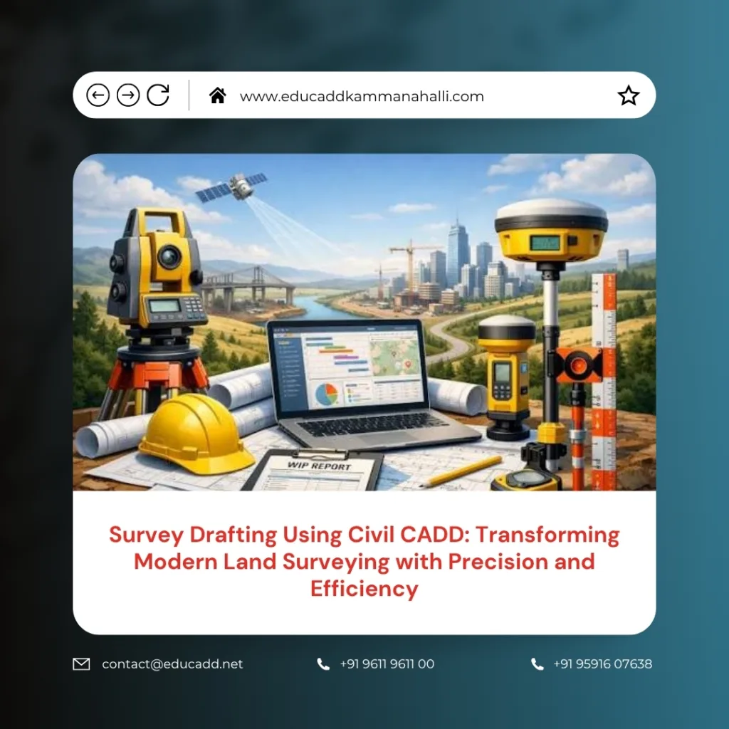
Traditionally, survey maps were prepared manually using drafting boards and measuring instruments. However, digital technology has transformed this process significantly. Today, surveyors collect data using Total Stations, GPS devices, drones, and laser scanners. They then import this information into Civil CADD software to create precise drawings.
As a result, survey drafting has become more accurate, faster, and easier to modify. Furthermore, digital drawings can be shared instantly among project stakeholders, improving collaboration throughout the project lifecycle.
The Role of Civil CADD in Survey Drafting
Civil CADD serves as a powerful platform for designing and drafting survey-related projects. It enables professionals to generate topographical maps, contour drawings, site layouts, road alignments, and land subdivision plans efficiently.
The software offers specialized tools that automate repetitive drafting tasks. Consequently, users can focus more on analysis and decision-making rather than manual drawing work. Additionally, Civil CADD helps maintain consistency across project documents.
Survey Drafting Using Civil CADD allows users to manage large datasets with ease. Even complex survey information can be represented visually through organized layers, symbols, and annotations. Therefore, engineers gain a better understanding of site conditions before initiating construction activities.
Importance of Accurate Survey Drafting
Accuracy remains one of the most critical requirements in any engineering project. Even minor drafting errors can lead to costly construction mistakes, project delays, and legal disputes.
Survey Drafting Using Civil CADD provides a reliable foundation for planning and design. When survey drawings accurately represent the site, engineers can make informed decisions regarding grading, drainage, road alignment, and structural placement.
Some major reasons why accurate survey drafting is important include:
- Ensures proper project planning and site development.
- Minimizes construction errors and rework costs.
Furthermore, precise survey drawings help obtain government approvals and regulatory clearances. They also support effective communication between engineers, contractors, clients, and authorities throughout the project.
Data Collection Methods Used in Survey Drafting
The quality of a survey drawing depends heavily on the accuracy of field data collection. Modern surveyors use advanced technologies that capture detailed information about the terrain and existing features.
Total Stations are widely used for measuring horizontal and vertical angles. GPS surveying systems provide accurate geographic coordinates. Meanwhile, drone surveys offer aerial data collection over large areas in a short period.
Additionally, laser scanning technology captures millions of data points to create highly detailed three-dimensional site models. Once collected, this data is processed and imported into Civil CADD software for drafting purposes.
Because these technologies provide highly accurate measurements, the resulting survey drawings become more reliable and useful for engineering analysis.
Creating Topographical Maps Using Civil CADD
Topographical mapping represents one of the most common applications of Survey Drafting Using Civil CADD. These maps display natural and man-made features, including contours, elevations, roads, buildings, trees, and water bodies.
Civil CADD enables surveyors to create contour lines automatically from elevation data. As a result, terrain variations become easy to visualize and analyze. Engineers can then evaluate slope conditions and determine suitable construction approaches.
Topographical maps support various infrastructure projects, including highways, railways, residential developments, industrial facilities, and urban planning initiatives. Therefore, accurate topographical drafting contributes significantly to successful project execution.
Boundary and Land Subdivision Drafting
Property boundary surveys are essential for determining legal ownership limits and land divisions. Survey Drafting Using Civil CADD simplifies the preparation of boundary maps by accurately representing property lines, dimensions, and reference points.
Surveyors can create subdivision layouts that divide large parcels into smaller plots for residential or commercial development. Moreover, the software helps maintain compliance with local regulations and zoning requirements.
The ability to modify layouts quickly provides significant flexibility during project planning. Consequently, land developers can evaluate multiple design options before finalizing subdivision plans.
Road and Infrastructure Survey Drafting
Infrastructure projects require detailed survey information to ensure safe and efficient design. Civil CADD supports the preparation of road alignment drawings, cross-sections, longitudinal profiles, and utility layouts.
Engineers use survey data to determine existing ground conditions and identify potential design challenges. Furthermore, accurate drafting improves coordination among transportation planners, utility engineers, and construction teams.
Key infrastructure applications include:
- Highway and roadway development projects.
- Drainage, sewer, and utility network planning.
Because infrastructure projects often involve large geographic areas, Civil CADD’s automation features significantly improve productivity and drafting efficiency.
Contour Generation and Terrain Modeling
Terrain modeling plays a crucial role in site development projects. Survey Drafting Using Civil CADD enables users to create digital terrain models that accurately represent ground conditions.
Contour generation tools convert elevation points into contour lines automatically. These contours help engineers assess slopes, drainage patterns, and earthwork requirements. Moreover, terrain models provide valuable insights for grading design and site optimization.
With accurate terrain visualization, project teams can identify potential challenges early in the planning stage. Consequently, they can reduce construction risks and improve project outcomes.
Advantages of Survey Drafting Using Civil CADD
The adoption of Civil CADD technology offers numerous advantages compared to traditional drafting methods. One of the most significant benefits is improved productivity. Tasks that once required several days can now be completed within hours.
Another major advantage is accuracy. Automated calculations reduce the possibility of human error while maintaining consistency across project documents. Additionally, digital drawings can be updated quickly whenever survey data changes.
The software also supports better documentation and data management. Therefore, organizations can maintain detailed project records and retrieve information whenever necessary. These benefits contribute directly to improved project quality and operational efficiency.
Improving Project Coordination Through Digital Drafting
Construction projects involve multiple stakeholders, including engineers, architects, contractors, surveyors, and government agencies. Effective communication among these parties is essential for project success.
Survey Drafting Using Civil CADD improves collaboration by creating standardized digital drawings that everyone can access and understand. Furthermore, electronic file sharing eliminates delays associated with physical documentation.
Project teams can review, comment on, and revise drawings efficiently. As a result, decision-making becomes faster and more informed. This enhanced coordination helps reduce misunderstandings and supports smoother project execution.
Career Opportunities in Survey Drafting
The demand for skilled survey drafting professionals continues to grow as infrastructure development expands worldwide. Organizations seek trained individuals who can process survey data and create accurate engineering drawings.
Professionals with expertise in Survey Drafting Using Civil CADD can pursue careers in construction companies, engineering consultancies, surveying firms, government agencies, and infrastructure development organizations.
Common job roles include Survey Draftsman, Civil CAD Technician, GIS Technician, Land Survey Assistant, Infrastructure Drafting Specialist, and Design Coordinator. Furthermore, experienced professionals often advance into project management and engineering design positions.
As industries increasingly adopt digital technologies, the demand for qualified Civil CADD professionals is expected to remain strong for many years.
Essential Skills Required for Survey Drafting Professionals
Successful survey drafting professionals require a combination of technical knowledge and practical skills. Understanding surveying principles, coordinate systems, contour mapping, and engineering drawing standards is fundamental.
Additionally, proficiency in Civil CADD software is essential for producing professional-quality drawings. Strong analytical abilities help users interpret field data accurately and identify potential issues before drafting begins.
Attention to detail remains equally important. Since survey drawings influence critical engineering decisions, even small inaccuracies can have significant consequences. Therefore, professionals must maintain high standards of precision and quality throughout the drafting process.
Future Trends in Survey Drafting Technology
Technology continues to reshape the surveying and drafting industry. Emerging innovations such as drone mapping, artificial intelligence, cloud-based collaboration, and Building Information Modeling (BIM) are transforming traditional workflows.
Survey Drafting Using Civil CADD is evolving to integrate these advanced technologies seamlessly. For example, drone-generated data can now be imported directly into drafting software for faster processing. Similarly, cloud platforms enable real-time collaboration among geographically dispersed teams.
Artificial intelligence is also improving data analysis and automation capabilities. Consequently, future survey drafting processes will become even more efficient, accurate, and intelligent. Organizations that embrace these innovations will gain a significant competitive advantage in the construction and infrastructure sectors.
Conclusion
Survey Drafting Using Civil CADD has revolutionized the way survey data is processed, analyzed, and presented in the civil engineering industry. By combining advanced surveying technologies with powerful drafting software, professionals can create highly accurate maps, plans, and engineering drawings that support successful project execution. Moreover, Civil CADD improves productivity, enhances collaboration, reduces errors, and streamlines project workflows.
As infrastructure development continues to accelerate across the globe, the importance of accurate survey drafting will only increase. Organizations require precise site information to make informed decisions, minimize risks, and optimize construction outcomes. Therefore, mastering Survey Drafting Using Civil CADD provides valuable career opportunities while contributing to the advancement of modern engineering and construction practices. Professionals who develop expertise in this field will remain highly sought after in the evolving digital construction landscape.

